|
The National Flood Insurance Program aims to reduce the impact of flooding on private and public structures. It does so by providing affordable insurance to property owners and by encouraging communities to adopt and enforce floodplain management regulations. These efforts help mitigate the effects of flooding on new and improved structures. Overall, the program reduces the socio-economic impact of disasters by promoting the purchase and retention of general risk insurance, but also of flood insurance, specifically. Signup to receive email updates.
You realize your flood insurance policy is about to expire and you’re on the fence about renewing: It hasn’t flooded in your area in years (or ever). And you really could use that extra money to buy something you really want. But wait! DON’T. RISK. IT. FACT: Flooding is the most common natural disaster in the United States, affecting every region and state, including yours. FACT: Flood insurance can be the difference between recovering and being financially devastated. FACT: The damage from just one inch of water can cost more than $20,000. FACT: If you allow your flood insurance policy to lapse for either more than 90 days, or twice for any number of days, you may be required to provide an Elevation Certificate (if you don't have one), and you may no longer be eligible for policy rate discounts you might have been receiving prior to the policy lapse. It's important to talk with your insurance agent before canceling or not renewing the policy. FACT: You can file a flood claim even if there is not a Presidential Disaster Declaration. FACT: Flood damage is not typically covered by homeowners insurance. FACT: No home is completely safe from potential flooding devastation—why risk it? FACT: If you live in a high risk flood zone, and you've received federal disaster assistance in the form of grants from FEMA or low-interest disaster loans from the U.S. Small Business Administration (SBA) following a Presidential Disaster Declaration, you must maintain flood insurance in order to be considered for any future federal disaster aid. FACT: Storms are not the only cause of floods. Flooding can be caused by dams or levees breaking, new development changing how water flows above and below ground, snowmelt and much more. FACT: Too often, Americans are caught off guard by the emotional and financial costs of flood damage. Check out your state's flood history with FEMA's data visualization tool. By rolling your cursor over each county, you can see how many flooding events have happened and learn more about the cost of flooding. Flood insurance helps more: Check out your state's flood history with FEMA's interactive data visualization tool. Roll your cursor over each county to see how many flooding events have happened. The tool allows you to compare how much FEMA and the U.S. Small Business Administration have provided in terms of federal disaster aid after Presidential Disaster Declarations to the amount the National Flood Insurance program has paid to its policyholders. It's easy to see that having flood insurance provides a lot more help for recovery.
0 Comments
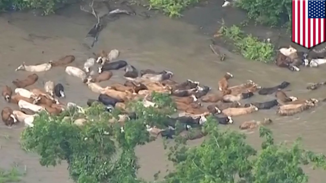
3/26/2017 0 Comments FLOODS AND YOUR LIVESTOCKFloods can impact animal health as well as human health. Make plans for your livestock and horses in the event you will need to evacuate your farm.
Before a Flood • Maintain an inventory. □ Keep a current list of all animals on your farm. □ Include their location and any records of vaccinations, testing and ownership. • Have identification for all animals. □ Make sure animals have some form of permanent identification (e.g., ear tags, tattoos). □ Ensure animals are properly vaccinated before exposure to floodwaters. • Prepare an evacuation kit. □ Handling equipment (e.g., halters, nose leads) □ Water, feed, and buckets □ Medications □ Tools and supplies needed for manure cleanup □ Safety and emergency items for your vehicles and trailers □ Gas powered generators • Make evacuation arrangements. □ Determine possible evacuation areas – higher elevation, alternate production facilities (e.g., temporary milking parlors). □ Determine several routes to these locations. □ Identify alternate water or power sources. □ Locate and prearrange feed and water delivery, needed equipment (e.g., milking) and services (e.g., milk pickup). □ Have well maintained backup generators for livestock production operations. □ Make transport arrangements (e.g., trucks, trailers) with experienced handlers and drivers. □ Condition animals to being loaded and transported. • Ensure a safe environment. □ Assess the stability and safety of barns and other structures. □ Remove dead trees or objects from fields or livestock areas that may serve as potential debris during a flood situation. During a Flood • Be aware animal behavior may change before, during and even after a disaster. □ If you must evacuate, ensure your family’s safety first □ If there is time - move or evacuate livestock and horses to higher ground. AVOID leaving animals behind. □ If there is no other alternative, keep gates or buildings open so they can escape high water. □ Provide access to safe free-choice food source, clean water and the safest living areas possible. □ Do not rely on automatic watering systems, because power may be lost. □ Establish escape routes to safe locations (higher elevation). □ Place your contact number and the name and number of your veterinarian on the building. After a Flood • Assess your animals and building structures. □ Survey damage to your barns and other structures; assess the stability and safety. □ Examine your animals closely; contact your veterinarian if you observe injuries or signs of illness. • Return animals only after the threat has passed and the safety of buildings or the area has been assessed. □ Release animals in a safe and enclosed area until familiarity of the surroundings can occur. • Provide non-contaminated feed or water. □ Provide clean, uncontaminated water. □ Do not feed flood damaged or moldy feed or hay. □ Do not use any feed or forage that may have been contaminated by chemical or pesticides. • Animal disposal. □ Record any animal deaths. □ Check with your state or local authorities for proper disposal methods for animal carcasses. • Prevent illness. □ Keep animals away from flood waters which may contain harmful bacteria or chemicals. □ Monitor animals daily for signs of illness. .Basement flooding is one of the most stressful, yet prevalent issues homeowners face on a yearly basis. Flood damage is not only difficult and timely to remove, but it can also ruin Super Bowl parties or lifelong memories for you and your family. Nonetheless, like almost any home issue, there are certain precautions homeowners can take to ensure no water comes anywhere near the basement. Below are our five tips to avoid a flooded basement.
Keep Gutters Free of Debris The best way to prevent basement flooding is by keeping your gutters free of debris. Preventing water from leaving your premises is never helpful. Your gutters were put in for a reason and driving water away from the home is its No. 1 function. If leaves or branches get caught in your gutters, water could start to pile up and leak right around your foundation. The more water near the foundation, the more likely your basement is going to flood. Cleaning your gutters is easy and should be done every spring and fall. See our step-by-step guide for cleaning your gutters here. Make Sure There are No Cracks in the Foundation Even if your home has no history of flood damage, it is vital that you seal cracks in the foundation walls and basement floors. I don’t need to explain that if there are holes in the foundation, water will get into the basement. There is no way around it. Many sealing solutions are DIY projects, but some require professional installation. Start by removing any crumbling concrete and repair all cracks in the walls and floors. Use masonry caulk on cracks less than 1/8 inches wide. Caulk only costs about $10 per tube. Patch wider cracks with epoxy filler and a putty knife. Remember to patch the places where pipes and tie rods pass through the concrete. Drylok Fast Plug is effective for sealing cracks in masonry. For complex cracks or those subjected to movement, hire a professional, as DIY kits are less reliable for this level of damage. To see what it cost to seal the cracks in your foundation, check out our basement sealing cost estimator. Position Downspouts Away from FoundationYour gutters could be as clean as whistles, but if you don’t have proper downspouts directing all that water away from your foundation, basement flooding can occur. They need to be thick and long enough to handle large amounts of water. Especially in areas of heavy rainfall, downspouts of 3X4 inches are highly recommended. They should be placing the rain gathered from the gutters at least five feet away from the home. If your current downspouts are not meeting these basic guidelines, you should think about extending them, another simple DIY project Every year, flash floods claim more lives in the United States than any other weather-related incident. The most common mistake is attempting to drive through a flooded area after a flood -- many drivers assume the waters are shallow enough to navigate. Travelers also encounter flash floods while camping or hiking in national parks and just about any other terrain with topography that includes hills, mountains, valleys, creeks and rivers.
Weather experts describe flash floods as “more water than you want in less time than you have.” Personal safety risks from flash floods can be minimized and avoided with smart planning. Here are 5 questions to ask in advance of a trip that will help travelers prepare for a flash flood. 1. Is an area flood-prone? Before setting up a campsite, pay attention to flash flood warning signs but don’t count on those signs to always be there. A deadly flash flood in June 2010 at Camp Albert Pike Recreation Area, a campground in Arkansas near the banks of the Little Missouri River, shows why due diligence is important. The area had experienced at least 10 river floods over the past 7 decades, yet no warning posters were present in the area. Don’t just rely on signs. Inquire with a campground office about an area’s flood history. When setting up a campsite, look for evidence of past floods, such as large logs littering a creek or riverbed and high-water marks on river banks and trees. Signs of past flooding in a canyon include water stains on canyon walls and debris hanging from bushes and low branches. 2. Does the weather report call for a flood watch? Check the weather forecast before a hike or a camp outing. If a flood watch is in effect, potential exists for heavy rains to create flash flooding within 6 to 24 hours. Postponing a trip a day or 2 could save a life. When hiking in the West, pay particular attention to weather reports from July to mid-September. That’s when severe thunderstorms are most likely to develop quickly. Finally, if visiting a flood-prone city, “on the ground” weather reports are available from the local convention and visitor’s bureau. 3. Does the area have cell phone or radio towers? Know the risks of camping in remote areas without access to a cell phone or radio. Roughly 75% of flash flood fatalities occur at night, when rapidly rising water is more difficult to detect. A weather radio that can broadcast weather alerts is essential. Such websites as CellReception offer details on cell phone coverage within national parks. Also call the campgrounds to ask if it is located close to a radio tower (the Albert Pike campground was not close to a tower). 4. When should you avoid driving in a flood? If you notice while driving during a storm that the middle line on the road is no longer visible, heed this advice from the National Weather Service. “Turn around, don’t drown.” Just six inches of water is enough to lift a vehicle off the ground. If you are caught in rising water, abandon the vehicle and seek higher ground. If you are trapped, wait until the car partially fills with water. Doors locked from water pressure should open once the water pressure is the same on both sides of the door. Also, press your feet against the windshield, which should then pop off. Finally, never drive around a “Road Closed” sign. It’s closed for a reason. 5. Have you formulated an evacuation plan? As a record-breaking flash flood in 2010 in Nashville, Tennessee proved, travelers don’t need to be in rural areas to encounter a flash flood. Before booking a hotel room, ask if the hotel has an evacuation plan (such as a makeshift shelter), as well as back-up generators. “Have a list of phone numbers and websites handy for the local convention and visitor’s bureau and office of emergency management,” says Butch Spyridon, president of the Nashville Convention and Visitors Bureau. “If you’re driving, be prepared to fill up your gas tank when you arrive at your destination -- don’t wait until you’re leaving town.” Whether you’re set to embark on a hike, camp outing or long-distance drive, staying vigilant -- and recognizing the signs of a flash flood -- should keep you safe and dry. With the recent spate of flash floods in Detroit and Baltimore and New York, a common question rising in the storms' aftermath asks how often certain areas of the country see flash floods. I put together some maps to show how frequently different parts of the United States experience these dangerous torrents of water.
A flash flood is the rapid onset of flooding due to extremely heavy rainfall in a relatively short period of time. In low-lying areas, especially near creeks, streams, and in hilly urban areas, water can rise very quickly during a heavy rainstorm. The floods sometimes occur with very little (or no) warning. One of the ways we can tell how frequently flash flooding occurs is to look at the number of flash flood warnings issued by the National Weather Service. Unlike tornadoes, which can develop so quickly that meteorologists and their technology can miss them and fail to issue a warning in time, it's hard to not issue a flash flood warning when the threat exists. Meteorologists use a product called "flash flood guidance" to aid them in determining when heavy rainfall presents a threat to those under the storms. The guidance shows how much rain has to fall in a certain period of time (say, two inches of rain in an hour) in order to create conditions favorable for the development of a flash flood. The factors that allow for the development of flash floods include soil moisture (soil too moist or too dry can't efficiently absorb heavy rainfall), terrain, proximity to bodies of water, and urbanization. Urbanization is an important factor in flash flooding. Unlike a thunderstorm over farmland where water can seep into the ground, when heavy rain falls over a city, it's hitting pavement and running off into the sewers. As Dr. Marshall Shepherd noted on Twitter last week, the sewer systems in cities were designed back in the 1950s and 1960s, and they aren't able to handle heavy rainfall events today. It usually takes a less intense storm to produce flash flooding in downtown areas than it would in a place like Carroll, Iowa. Let's take a look at seven years' worth of flash flood warnings (almost 27,000 in total) issued by the National Weather Service between early 2007 and July 2014. I chose 2007 for two reasons: 1) the NWS began issuing "storm-based warnings" in October of that year, which limits a warning polygon to the area affected by the storm rather than for the entire county; and 2) the Iowa Environmental Mesonet's flash flood warning data for 2006 is missing, and I would rather not have an entire year missing from the data if I wanted to go back further to 10 years. United StatesTaking a look at the entire country, it's clear that most of the flash flood warnings issued by the NWS occur east of the Rockies, with two areas of higher density around the Mississippi River and the I-95 corridor from D.C. to Boston. The southwestern United States also stands out as a hotbed of flash flooding. NortheastWe'll start in the northeast and work our way clockwise through the rest of the country. The frequency of flash flood warnings over the seven-year period lowers as you move north and west away from the megalopolis. The highest density of flash flooding occurs in the immediate vicinity of downtown areas such as New York City, Philadelphia, and Washington/Baltimore. The densely-packed streets, parking lots, and sidewalks don't allow the water to absorb into the ground, forcing it to run off and increase the risk of urban flash flooding. Mid-AtlanticIn the Mid-Atlantic region, the warning frequency starts to grow a little blocky. As a resident of central North Carolina, I can attest to the fact that the state often sees flash flood warnings. Thunderstorms tend to move through this area very slowly, creating runoff issues, especially in cities such as Greensboro and Raleigh. If you're wondering why the warnings are so blocky, it's a result of bureaucracy. There are more than 100 National Weather Service offices in the United States, and each one has a "county warning area," or an area of responsibility for which they issue forecasts and warnings. They can't issue warnings outside of their CWA boundaries, so the end result is a blocky mess of warnings when you zoom-out to a regional view. Here's the same warning map with the NWS office boundaries drawn on: It shows there's no real environmental reason for the blocky nature of the warnings, but rather it's the result of jurisdiction and one group of forecasters seeing a higher threat than forecasters at a neighboring office. SoutheastThe southeastern United States is able to hold its water a little better given the relatively sparse population density compared to the northeast, but that changes once you get into the swampy areas of the northern Gulf Coast. Southern Alabama and Mississippi see some of the heaviest rainfall in the country (Mobile is the wettest city in the U.S.), so the water frequently overwhelms the infrastructure and leads to flooding. The propensity for heavy rainfall along with the low-lying, saturated nature of the terrain in the Mississippi River Valley also leads to frequent flash flooding, accounting for the near-solid green color on the map. FloridaIf you pick up one message from this article, it's that we humans are the cause of a lot of the flash flooding we see on the news. Just look at Florida as an example. Florida as a whole doesn't really see much flash flooding, but take a close look at the strip of cities along the state's southeastern coast. Most of the flash flood warnings in Florida are confined to cities where water has a hard time running off into the environment. South-CentralTaking a look at the south-central U.S. doesn't yield many surprises. The blocky nature of the warnings in Texas is a result of NWS offices issuing warnings based on counties rather than the storms, in addition to the office boundaries (look around Lubbock for a great example). Midwest/PlainsMoving north so we don't forget our friends in the Midwest, much of the flash flooding that occurs in the region is the result of thunderstorm training (heavy storms constantly moving over the same area like train cars on railroad tracks). The soil is very fertile in the area and can hold its fair share of moisture, but when it gets too saturated, the water just runs off and creates a dangerous situation for residents. Again, for the urban effect, look at the dense warnings around downtown Chicago and Minneapolis. Rockies/PlainsAs we move into the western Plains and the Rockies, flash flooding becomes more sparse due to the general lack of convection most of the year. The worst flooding in the area often occurs along the eastern side of the Rockies in eastern Colorado, especially around Colorado Springs. SouthwestThe southwestern United States sees quite a few flash flooding events thanks to the monsoon season. The desert areas have an interesting feature called "arroyos," which are also called "washes" or "dry creeks" depending on who's talking. These are dry creeks which stay dry until there's a heavy rainfall event upstream. Oftentimes, arroyos fill up all at once, with a wall of water rushing downstream from the thunderstorm. Every year people are killed because they're hiking in an arroyo and there's a thunderstorm miles away, sometimes so far away that it's sunny where the doomed hikers are located. Above is a video of flash flooding in an arroyo in Nevada, showing how it goes from bone dry to a few feet of swiftly-moving water in less than two minutes. NorthwestThe northwestern United States doesn't see many flash flood warnings due to a general lack of thunderstorm activity, but heavy rainfall in valleys can prove dangerous, especially with the risk of mudslides. Why Doesn't the West Coast See Thunderstorms?While people along and east of the Rockies seem to have thunderstorms almost every other day this… HawaiiHawaii often sees flash flood warnings during heavy thunderstorms, except for the leeward side of Mauna Kea and Mauna Loa. Puerto RicoMuch like Hawaii, Puerto Rico's tropical location allows the territory to see frequent heavy rainfall events, some of which produce flash flooding. The NWS office in Puerto Rico is also responsible for issuing warnings for Vieques and Culebra (the two islands just off PR's eastern coast) as well as the U.S. Virgin Islands, which are the easternmost two islands covered in green. A slight but noticeable pattern emerges on Puerto Rico, as the windward side of the island sees flash flooding more frequently than the leeward side. Overall, flash flooding in the United States most frequently occurs pretty much where you'd expect — highly urbanized cities and areas that have high soil moisture (parts of the Midwest) and extremely low soil moisture (the desert southwest). Regardless of where you live, if the NWS ever issues a flash flood warning, don't ignore it. Driving through a flooded roadway is one of the stupidest ways to die. The need to go somewhere isn't that important, especially since people who drive through floodwaters not only risk their lives if they get stuck, but the lives of those who have to wade out there to rescue them.  Published July 03, 2014 FoxNews.com Arthur strengthened to a hurricane in the Atlantic Thursday and threatened to give North Carolina a glancing blow on Independence Day, prompting thousands of vacationers and residents to leave parts of the state's popular flood-prone Outer Banks. The hurricane's maximum sustained winds Thursday morning were 80 mph as the storm's outer bands started to reach southern parts of North Carolina. Hatteras island was under a mandatory evacuation order for visitors and residents, with officials asking an estimated 35,000 people to leave through North Carolina Route 12, the only road on and off the island. Forecasters expect Arthur to whip past the Outer Banks -- a 200-mile string of narrow barrier islands with about 57,000 permanent residents -- on Friday without making landfall but still bringing rain, heavy winds, storm surge and dangerous rip tides. Before the storm hit, tourism officials had expected 250,000 people to travel to the Outer Banks for the holiday weekend. Gov. Pat McCrory warned people not to risk their safety by trying to salvage their barbecues and pre-paid beach vacations. "Don't put your stupid hat on," McCrory said, urging swimmers and surfers to avoid the water regardless of how good the waves might look. McCrory also declared a state of emergency for 25 coastal and adjoining counties. "Our major goal is to ensure that no lives are lost during this upcoming storm," including those of emergency workers, McCrory said. The National Hurricane Center predicted Arthur would swipe the North Carolina coast early Friday with winds of up to 85 mph and then be off the coast of New England later in the day, eventually making landfall in Canada's maritime provinces as a tropical storm. Outer Banks residents and out-of-town visitors who fail to evacuate ahead of the hurricane's expected arrival should prepare for possibly getting stuck for several days without food, water or power, National Hurricane Center forecaster Stacy Steward said Thursday. "We want the public to take this system very seriously, go ahead and start their preparations because time is beginning to run out," he said. The first named storm of the Atlantic season prompted a hurricane warning for much of the North Carolina coast. Tropical storm warnings were in effect for coastal areas in South Carolina and Virginia. On the Outer Banks' Ocracoke Island, accessible only by ferry, a voluntary evacuation was under way. Arthur is centered about 300 miles southwest of Cape Hatteras, North Carolina, and is moving north near 9 mph. Officials, hotel owners and would-be vacationers as far north as New England were also carefully watching forecasts. The storm was enough of a concern that officials in Boston decided to move the annual Boston Pops July 4th concert and fireworks show up by a day because of potential heavy rain Friday night. And rip tides were a threat as far north as New Jersey. One of the Outer Banks visitors who planned to leave Thursday was Gary Reinhardt, 63, of Sarasota, Florida. "I'm worried about the road. It took way too long to get here," he said, a reference to the two-and-a-half hours it took him and his wife, Lori Reinhardt, to get onto the island last Sunday in normal summertime traffic, when no storms were in sight. Other areas of the Outer Banks were taking a cautious, but still-optimistic approach: No evacuations had been ordered for areas north of Hatteras, including the popular town of Kill Devil Hills, which was the site of the Wright brothers' first controlled, powered airplane flights in December 1903. Nancy Janitz, 60, of Jacksonville, North Carolina, said she was ready, thanks to technology. "I have my NOAA radio, and I keep tabs on Twitter and Facebook for updates," she said. "I'm as prepared as I can possibly be." Forecasters had thought Arthur would reach hurricane status later Thursday, but its increasing strength and a defined eye prompted them to revise the projection late Wednesday, the Miami Herald reported. The worst of the storm should occur at Cape Hatteras about dawn Friday, with 3 to 5 inches of rain and sustained winds up to 85 mph, said Tony Saavedra, a meteorologist at the National Weather Service. But forecasters said that by later Friday, the effects of Arthur would be past the Outer Banks, with the rest of the weekend salvaged. In the Myrtle Beach area, the heart of South Carolina's $18 billion tourism industry, Arthur was expected to move in by Thursday night, spinning wind gusts from 40 to 50 mph toward the high-rise hotels and condominiums lining the oceanfront. Farther south, in Hilton Head Island on the state's southern tip, most were confident would pass well out at sea. "It will be a sold-out weekend," said Charlie Clark, a spokeswoman for the local Chamber of Commerce. "... We're not getting calls from visitors asking what's up with this storm." The Associated Press contributed to this report. |
Insurance InfoFor all the latest up to date insurance rates for Cape Cod, MA. CategoriesAll 5 Ways To Prevent Your Basement From Flooding Arbella Insurance Auto Insurance Bad Weather Driving Best Boat Insurance Best Car Insurance Best Insurance Best Policy Bourne Flood Insurance Bourne Home Insurance Buildings Buildings And Content Insurance Cape Cod Boat Cape Cod Flood Insurance Cape Cod Home Cape Cod Home Insurance Cape Cod Home Insurance Best Cape Cod Home Insurance Marthas Vineyard Insurance Falmouth Home Insurance Mashpee Home Insurance Cape Cod Home Insurance Falmouth Home Insurance Cape Cod Real Estate Cape Cod Home Insurance Falmouth Home Insurance Cape Cod Real Estate Universal Home Cape Cod Home Insurance Falmouth Home Insurance Cape Cod Real Estate Universal Home Universal Property Cape Cod Insurance Agency Home And Auto Insurance Car Insurance Car Owner Guides Centerville Home Insurance Home Insurance Agent Cape Cod Insurance Agent Cape Cod Insurance Agency Home And Auto Insurance Coastal Agents Alliance Community Outreach Contents Contents Insurance Dennis Home Insurance Yarmouth Home Insurance Vineyard Haven Home Insurance Nantucket Home Insurance Disability Safety Disaster Safety For People With Disabilities: What To Do When Emergency Weather Strikes Do I Need Flood Insurance Driver Safety Driving To Safety: The Car Owner's Guide To Emergency Evacuation Emergency Evacuation Emergency Evacuation Preparedness Falmouth Flood Insurance Falmouth Home Insurance FEMA Flood Program Flash Flood Safety: 5 Must Ask Questions Flash Flood Safety: 5 Must-Ask Questions Flood Flood Damage Flooding Flood Insurance Flood Insurance Costs Flood Insurance Rates FLOODS AND YOUR LIVESTOCK Guide Guide To Safe Driving Home Home And Car Insurance Home Insurance Home Insurance Agent Cape Cod Insurance Agent Cape Cod Insurance Agency Home And Auto Insurance Home Insurance Cape Cod Home Insurance Best Cape Cod Home Insurance Marthas Vineyard Insurance Falmouth Home Insurance Home Insurance Cape Cod Home Insurance Best Cape Cod Home Insurance Marthas Vineyard Insurance Falmouth Home Insurance Mashpee Home Insurance Sandwich Home Insurance Bourne Home Insurance North Falmouth Home Insurance Marion Home Insurance Household Insurance Information & Resources Insurance Insurance Emergency Strikes' Insurance Flood Insurance Policy Maps: Which Parts Of The U.S. See Flash Floods Most Often? Marion Home Insurance Plymouth Home Insurance Dennis Home Insurance Yarmouth Home Insurance Mashpee Flood Insurance Mashpee Home Insurance Mashpee Home Insurance Sandwich Home Insurance Bourne Home Insurance North Falmouth Home Insurance Narragansett Insurance National Flood Insurance Program Plymouth Home Insurance Dennis Home Insurance Yarmouth Home Insurance Vineyard Haven Home Insurance Nantucket Home Insurance Yarmouth Home Insurance Possessions Preparing For Vehicle Emergencies Prevent Flooding Replace Right Insurance Safe Driving Guides Safety Guide Safety Guides Tags: Safety Safety Insurance Sandwich Home Insurance Sandwich Home Insurance Bourne Home Insurance North Falmouth Home Insurance Marion Home Insurance Plymouth Home Insurance The Ultimate Guide To Hurricane Facts Universal Home Universal Property UPC Insurance MPIUA Mass Property Fair Plan Fair Plan Alternative Universal Insurance Universal Property UPC Insurance MPIUA Mass Property Fair Plan Fair Plan Alternative UPCIC Insurance UPC Insurance UPC Insurance MPIUA Mass Property Fair Plan Fair Plan Alternative Vehicle Emergency Kit Vehicle Safety Vineyard Haven Home Insurance Nantucket Home Insurance Yarmouth Home Insurance Centerville Home Insurance Water Damage Wind Vs. Hurricane Deductibles Wright Flood Yacht Insurance Yarmouth Home Insurance Centerville Home Insurance Home Insurance Agent Cape Cod Insurance Agent Archives
June 2021
|
-
HOME
- Cape Cod, MA - Send me a Home Quote
- Cape Cod, MA Home Insurance Protection
- Arbella Insurance Discounts
- Lloyds of London History
- Safety Insurance Discounts
- Cape Cod Massachusetts - Alternative to MPIUA - MA Property Insurance Underwriting Association "Fair Plan"
- Cape Cod Real Estate
- Hurricane Preparedness
- Hurricane Survival
- Hurricane Aftermath
- FLOOD
- Cape Cod Home Insurance
- AUTO
- BOAT
- BUSINESS
- LIFE
- OFFICES
- ABOUT US
- eServices
- Agent Login
- Contact Us
- Privacy Policy
Search by typing & pressing enter






 RSS Feed
