
|
3/26/2017 1 Comment Disaster Safety for People with Disabilities: What to Do When Emergency Weather Strikes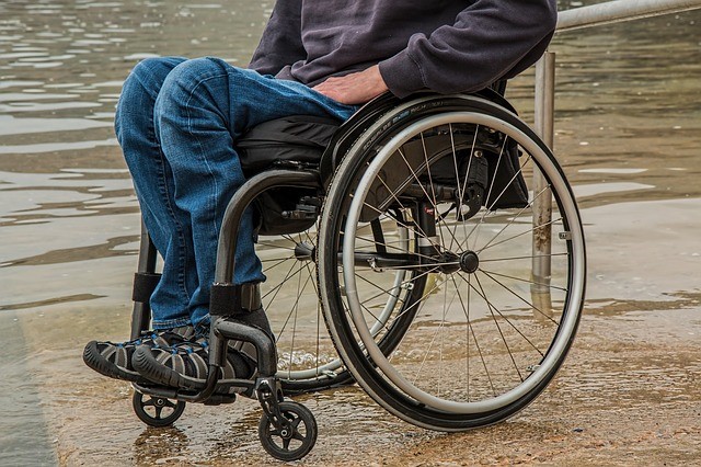 Disaster Safety for People with Disabilities: What to Do When Emergency Weather Strikes We all like to believe that when a major hurricane is headed our way or a tornado warning is issued, we’ll know exactly what to do. But inclement weather is unpredictable, and it can be frightening and chaotic to handle in the moment. It’s crucial to prepare and plan well in advance for any natural disaster that your area is prone to, especially if you have a disability that could require additional safety considerations.
This disaster safety guide will help you know what hurdles to anticipate, factors to consider, and ultimately, what to do when emergency weather occurs. It will take into account people at all different ability levels and the kinds of challenges they might encounter during hurricanes, blizzards, landslides, tornadoes and earthquakes. Be sure to consult with your doctor about any additional precautions you might need to take, as each person may have more specific needs to address. General Preparation Regardless of where you live or the specific inclement weather your area may see, it’s important to take a few general safety precautions. First, establish a personal emergency network of family, friends, neighbors, and coworkers who can help you in the event of a disaster. You should have a list of at least three people for each place you spend regular time in: home, work, school, vacation homes, or timeshares. Some people may pop up on multiple lists, but the more options you have, the better. Their job is to check in on you when a storm is brewing or weather watch is issued, and make sure you’ll have a safe place to be. You’ll need to establish how everyone will get in touch, keeping in mind that phone service might be limited. For those nearby, it can be as basic as a knock on the wall to your neighbor or hanging a piece of cloth outside your window. Your network will need to have any necessary keys or security codes to reach you, so make sure it’s someone you trust implicitly. Go over how to use and transport any special equipment you’ll need, as well as medications that will need to be taken with you. Put together a disaster safety kit with about a week’s worth of supplies and keep it somewhere secure but easily accessible. If you have a service dog, put aside the items they’ll need. You’ll also want to let your service animal spend some time getting to know the members of your network. It will be crucial that the animal trusts those people to lead the way to safety in the event of an emergency. Find out the names and locations of designated safe zones and shelters in your area, noting which ones are closest to your home, workplace, or any other place you are likely to be in the event of an emergency, such as a friend’s home. Make practice drives to become familiar with the route, learn how long it takes to get there, and to get a good look at the surrounding area. Practice a faux emergency to go over all the steps needed, from getting into your front door to loading up your equipment to transporting you to the car, for example. Pay close attention to how long each task takes you to do, and look for opportunities to cut down your time. Even just moving your emergency kit closer to the front door can save precious seconds. Image via PixabayReplenish your supply kit as necessary, and consult your doctor about the shelf lives of your medications so they don’t lose their effectiveness. Even if you’ll be planning to evacuate your home in most emergency situations, don’t forget to set aside plenty of bottled water, non-perishable foods, and sanitary supplies. If dangerous conditions make it difficult to reach you, it’s crucial that you’ll have the means to get by in the meantime. If you use powered medical equipment in your daily life, you may want to consider buying a generator for emergency situations. It may be a sizable investment now, but you never know when you could end up needing it. Finally, go over your insurance policies to be sure you completely understand everything that you are and aren’t covered for. Ask specifically how your medical equipment is protected, and if it’s only guaranteed under certain conditions. Flood insurance and water damage is often not included in certain policies, so don’t be afraid to ask for clarification from your agent. HurricanesIf you live in a tropical or coastal region, it’s important to be aware of the peak hurricane season in your area. If you live on the Atlantic Coast, you’re at highest risk from June 1 until November 30. For the Pacific Coast, hurricanes are most likely May 15 through November 30. Pay attention to weather reports year-round so you’ll know in advance if a particularly rough season is ahead, and make it a consistent conversation with your safety network. Be sure that if a colleague will be your work ally, you talk to your partner about where you’ll go if an emergency occurs during business hours. Plan to first get yourself to safety, and then check in as soon as possible. When your peak season does roll around, keep a close eye on any major storms that are brewing, even if they aren’t predicted to hit your area. Hurricanes have been known to make sudden, dramatic shifts in direction, so the more updated you stay on how they’re progressing, the less likely they’ll catch you off-guard. Know the designated evacuation routes for your region and how to reach them quickly; even if a spouse or caregiver will be driving, you can help guide them if you know the way. However, be prepared for the possibility of flooded roads and scout out some alternative routes in advance. Remember: the rule is turn around, don’t drown, so be prepared. If a hurricane watch is issued, you’ll need to establish whether or not you’ll be staying in your home. Heed the advice of the National Weather Service and plan to evacuate if they give the order. Keep in mind that even if the storm isn’t dangerous enough to warrant an evacuation, strong winds and rain could still knock out power lines, and flooding can occur in low-lying areas — which could make it difficult or even dangerous if you’ll need power for any equipment. Play it safe not only to protect your family, but to eliminate as much stress from the situation as possible. Image via PixabayIf you have ample warning to prepare for a hurricane’s arrival, do what you can to protect any medical equipment you’ll leave behind. Double wrap supplies like gauze and tools in plastic bags and store them somewhere secure and high in case of flooding. If possible, wrap electronic and large equipment in plastic and move them to the highest room you can. Don’t prioritize any of this over your own safety, but protect what you can if there’s time. Anticipate difficult mobility conditions even if there isn’t immediate flooding in your region. For example, if you normally use a motorized chair, it might be quicker and easier to use your backup manual chair for the evacuation. This can be especially helpful in instances where a neighbor or relative who doesn’t have the necessary car modifications to transport your motor chair. Grab heavy boots and work gloves to protect yourself from debris. BlizzardsAs with hurricanes, you often have a bit of warning with blizzards, so stay informed and alert to updates. If you have a generator, check to be sure it’s in good working condition so it will be ready the moment you need it. It’s a good idea to keep backup equipment batteries as part of your emergency supply kit, but if you have the safe opportunity to buy more when a blizzard is on the way, do so. You’ll also want to check in with your doctor. Request any medication refills you might need, taking into consideration that roads may be blocked and businesses closed for several days at a time. Ask if there are any aspects to your condition that could be exacerbated by the freezing temperatures and what you can do to prevent problems. There may even be some specific non-perishable foods your physician can recommend that will be especially nutritious for you to focus on until grocery shopping is possible. Be over-prepared when it comes to protecting yourself from the cold, even if you’re not especially susceptible to problems from it. Insulate your home as much as possible — hanging dark curtains over a window with direct sun can make an important difference — and bundle up. Be especially mindful of warming your fingers, toes, ears, nose, and cheeks, as these areas can be quite prone to frostnip and frostbite. And don’t forget to have some extra blankets set aside for your service animal if you have one. LandslidesUnfortunately, landslides can be pretty unpredictable and happen quickly. If you live alone and there are warnings that a landslide could occur overnight, you may want to stay with a neighbor or nearby loved one so that you can have a quicker evacuation if needed. Bring any portable medical equipment you could need within the next day or two, as well as medication and other supplies. If you are in imminent danger from a landslide, get in touch with your nearest emergency network contact immediately. Grab only absolute necessities for the next few hours, and don’t lose any time trying to protect what you leave behind. Because this kind of natural disaster happens so quickly, time will be your biggest obstacle. You’ll be able to figure out replacement nonessential supplies later on, but getting to safety means acting fast. Image via PixabayMake sure that if your home or workplace is affected by a landslide, you don’t return until officials say it’s safe. Check your equipment closely for damage, then report any damage and find out about replacements and repairs. If your house is clear but traveling is difficult because of damaged roads, use the medication from your emergency supply kit. TornadoesMany places have tornado sirens that sound when a warning has been issued, but it can pose a major problem for someone who has limited hearing. And if sirens aren’t working or cued up in time, it can be easy to miss an issued warning if you’re in class, working, or otherwise occupied. Be sure your emergency network knows to contact you the moment a tornado watch has been issued — the simpler the better, so a clear, emphasized text message such as “TORNADO WATCH” can suffice. Even if no cyclones are on the ground yet, you should get to a safe place immediately. This is especially important if you are on a high floor and have a physical disability; you’ll need to get to lower ground immediately, but getting on an elevator could be dangerous if the power goes out. Since you may have to depend on stairs, you’ll want to get moving as soon as possible to allow yourself plenty of time. This should be a procedure you practice every once in awhile with your emergency network. The more confident you feel about being able to get to safety, the calmer you’ll be in the chaos of a real tornado watch. You’ll need to get as far away from windows and exterior doors as possible, ideally underground. If you have a service animal, make sure it stays on its leash. Even if it normally doesn’t need one, the chaos will almost certainly make it nervous, and might even cause it to suddenly run away out of fear. Those with a visual impairment should hold hands or maintain some kind of physical anchor to their emergency ally, and established hand signals may be helpful communication devices for people with hearing impairments. Once you’re in the basement, storm shelter, or lowest level, get under a heavy table or desk. If you’re in a wheelchair, don’t worry about getting the chair underneath with you — you are the priority. Duck down and cover your head and neck with your arms. Stay where you are and don’t go outside until you’re given an official all-clear signal. Be careful about possible debris on the ground when you do venture out, and wear heavy boots and work gloves if possible. Earthquakes Perhaps the most unpredictable of natural disasters, earthquakes require the quickest thinking. The moment one strikes, you should drop, cover, and hold — if you have a service animal, take it with you. If you’re in a wheelchair, lock it in place and get out of it and under a heavy table or desk. If you’re unable to get out and no one is around to help you, lock the brakes, then cover and hold as best you can — be sure to stay as far as you can from windows and other glass. Image via PixabayIf you’re in bed when an earthquake strikes, use your pillows, blankets, and sheets to shield yourself from falling debris. Stay where you are for several minutes afterward, bracing for possible aftershocks. If you’re injured during the event, stay put and contact 911 immediately, then ask paramedics to contact your emergency network. Contact your emergency network first if you’re not injured. Let them know the condition of your house and if you need any assistance. If you’re able to move around the house on your own, be extremely careful and wear thick-soled shoes. If you have a manual wheelchair, wear protective gloves in case your wheels roll over any sharp debris. People with a visual impairment should sit tight until someone can arrive to assess their situation. If no one else is present at the home, a member of the emergency network should stop by to see the house. If the damage is extensive, it may be necessary to wait for emergency professionals’ guidance. Be sure to check your service animal for any injuries and communicate them to your emergency network. Your animal will be especially stressed and probably anxious from the earthquake, so try to keep it as calm as possible. If there are emergency workers nearby, let them know if the animal is hurt and needs emergency care. The key to disaster safety is preparation, so do all that you can to stay ahead of the storm. Have regular practice drills with your family for each emergency your area could face. If you’re a caregiver, have practice drills with your loved one. If there is a cognitive disability to consider, be sure not to confuse or scare him or her, and emphasize when it’s only practice. Always remember: there’s no such thing as being too prepared for natural disasters!
1 Comment
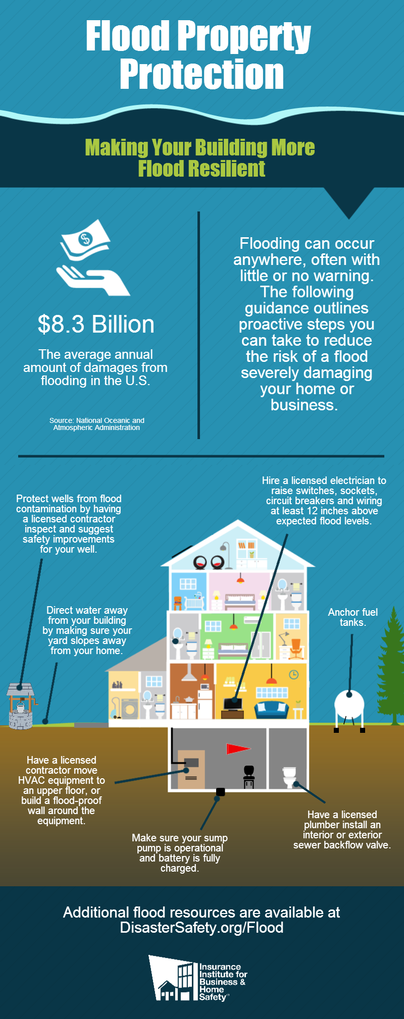
 Water Damage Restoration & Clean Up Checklist After the flood waters recede and the clean up has been done, most folks want to get back into their homes or businesses and start rebuilding. The problem is that wood that has been submerged in water has likely absorbed a large amount of water. Rebuilding too quickly after a flood can cause continuing problems such as mold growth, insect infestations, and deterioration of the wood and wall coverings.
Flood waters are not clean water; therefore, most porous building materials must be removed and replaced with new materials. Caution!
1. Flood Insurance Claims If you have flood insurance, contact your insurance adjuster immediately.
Be sure all electric and gas services are turned off before entering the premises for the first time.
Until your local water company, utility, or public health department declares your water source safe, purify your water, not only for drinking and cooking, but also for washing any part of the body or dishes.
Remove all furniture, bedding, and carpeting to outdoors to be cleaned and dried (or discarded).
Open flooded walls, even if they appear undamaged, to prevent mold, odor, and structural decay later.
1. Subfloors
To reduce mold and damage, clean and dry as soon as flood waters recede. Do not sand or scrape lead-based paint.
Clean and dry the submerged household appliance before starting.
Take furniture outdoors to clean.
Aggressively control mold in the weeks and months after the flood.
Avoid disturbing and spreading mold spores indoors. Clean mildewed items outdoors. Learn and take precautions to minimize exposure to mold.
 The Ultimate Guide to Hurricane Facts, Information & Resources What Is a Hurricane?A hurricane is a kind of tropical cyclone that includes organized thunder storms but no fronts. (Fronts are two air masses of different densities, such as cold fronts and warm fronts.) Tropical cyclones are measured in escalating degrees: When the winds in a cyclone are below 39 mph, it is considered a tropical depression. When the maximum sustained winds in a tropical cyclone reach 39 mph, it graduates to a tropical storm. Finally, when those winds sustain 74 mph or higher, the cyclone graduates further to a hurricane.
Hurricanes are not the same thing as tornadoes. Many people falsely believe that hurricanes are simply tornadoes forming over the ocean. In fact, the only thing the two have in common is that they are both swirling, destructive columns of air. The main differences between hurricanes and tornadoes are:
Hurricane Damage ScaleHurricanes, like tornadoes, are defined by categories on the “Saffir-Simpson scale.” This scale measures the potential for damage caused by hurricanes, based on the strength of the sustained winds. (Sustained winds are those that last one minute or more.)
Interesting Hurricane Facts
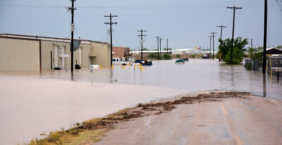
 Maps: Which Parts of the U.S. See Flash Floods Most Often? With the recent spate of flash floods in Detroit and Baltimore and New York, a common question rising in the storms' aftermath asks how often certain areas of the country see flash floods. I put together some maps to show how frequently different parts of the United States experience these dangerous torrents of water.
A flash flood is the rapid onset of flooding due to extremely heavy rainfall in a relatively short period of time. In low-lying areas, especially near creeks, streams, and in hilly urban areas, water can rise very quickly during a heavy rainstorm. The floods sometimes occur with very little (or no) warning. One of the ways we can tell how frequently flash flooding occurs is to look at the number of flash flood warnings issued by the National Weather Service. Unlike tornadoes, which can develop so quickly that meteorologists and their technology can miss them and fail to issue a warning in time, it's hard to not issue a flash flood warning when the threat exists. Meteorologists use a product called "flash flood guidance" to aid them in determining when heavy rainfall presents a threat to those under the storms. The guidance shows how much rain has to fall in a certain period of time (say, two inches of rain in an hour) in order to create conditions favorable for the development of a flash flood. The factors that allow for the development of flash floods include soil moisture (soil too moist or too dry can't efficiently absorb heavy rainfall), terrain, proximity to bodies of water, and urbanization. Urbanization is an important factor in flash flooding. Unlike a thunderstorm over farmland where water can seep into the ground, when heavy rain falls over a city, it's hitting pavement and running off into the sewers. As Dr. Marshall Shepherd noted on Twitter last week, the sewer systems in cities were designed back in the 1950s and 1960s, and they aren't able to handle heavy rainfall events today. It usually takes a less intense storm to produce flash flooding in downtown areas than it would in a place like Carroll, Iowa. Let's take a look at seven years' worth of flash flood warnings (almost 27,000 in total) issued by the National Weather Service between early 2007 and July 2014. I chose 2007 for two reasons: 1) the NWS began issuing "storm-based warnings" in October of that year, which limits a warning polygon to the area affected by the storm rather than for the entire county; and 2) the Iowa Environmental Mesonet's flash flood warning data for 2006 is missing, and I would rather not have an entire year missing from the data if I wanted to go back further to 10 years. United StatesTaking a look at the entire country, it's clear that most of the flash flood warnings issued by the NWS occur east of the Rockies, with two areas of higher density around the Mississippi River and the I-95 corridor from D.C. to Boston. The southwestern United States also stands out as a hotbed of flash flooding. NortheastWe'll start in the northeast and work our way clockwise through the rest of the country. The frequency of flash flood warnings over the seven-year period lowers as you move north and west away from the megalopolis. The highest density of flash flooding occurs in the immediate vicinity of downtown areas such as New York City, Philadelphia, and Washington/Baltimore. The densely-packed streets, parking lots, and sidewalks don't allow the water to absorb into the ground, forcing it to run off and increase the risk of urban flash flooding. Mid-AtlanticIn the Mid-Atlantic region, the warning frequency starts to grow a little blocky. As a resident of central North Carolina, I can attest to the fact that the state often sees flash flood warnings. Thunderstorms tend to move through this area very slowly, creating runoff issues, especially in cities such as Greensboro and Raleigh. If you're wondering why the warnings are so blocky, it's a result of bureaucracy. There are more than 100 National Weather Service offices in the United States, and each one has a "county warning area," or an area of responsibility for which they issue forecasts and warnings. They can't issue warnings outside of their CWA boundaries, so the end result is a blocky mess of warnings when you zoom-out to a regional view. Here's the same warning map with the NWS office boundaries drawn on: It shows there's no real environmental reason for the blocky nature of the warnings, but rather it's the result of jurisdiction and one group of forecasters seeing a higher threat than forecasters at a neighboring office. SoutheastThe southeastern United States is able to hold its water a little better given the relatively sparse population density compared to the northeast, but that changes once you get into the swampy areas of the northern Gulf Coast. Southern Alabama and Mississippi see some of the heaviest rainfall in the country (Mobile is the wettest city in the U.S.), so the water frequently overwhelms the infrastructure and leads to flooding. The propensity for heavy rainfall along with the low-lying, saturated nature of the terrain in the Mississippi River Valley also leads to frequent flash flooding, accounting for the near-solid green color on the map. FloridaIf you pick up one message from this article, it's that we humans are the cause of a lot of the flash flooding we see on the news. Just look at Florida as an example. Florida as a whole doesn't really see much flash flooding, but take a close look at the strip of cities along the state's southeastern coast. Most of the flash flood warnings in Florida are confined to cities where water has a hard time running off into the environment. South-CentralTaking a look at the south-central U.S. doesn't yield many surprises. The blocky nature of the warnings in Texas is a result of NWS offices issuing warnings based on counties rather than the storms, in addition to the office boundaries (look around Lubbock for a great example). Midwest/PlainsMoving north so we don't forget our friends in the Midwest, much of the flash flooding that occurs in the region is the result of thunderstorm training (heavy storms constantly moving over the same area like train cars on railroad tracks). The soil is very fertile in the area and can hold its fair share of moisture, but when it gets too saturated, the water just runs off and creates a dangerous situation for residents. Again, for the urban effect, look at the dense warnings around downtown Chicago and Minneapolis. Rockies/PlainsAs we move into the western Plains and the Rockies, flash flooding becomes more sparse due to the general lack of convection most of the year. The worst flooding in the area often occurs along the eastern side of the Rockies in eastern Colorado, especially around Colorado Springs. SouthwestThe southwestern United States sees quite a few flash flooding events thanks to the monsoon season. The desert areas have an interesting feature called "arroyos," which are also called "washes" or "dry creeks" depending on who's talking. These are dry creeks which stay dry until there's a heavy rainfall event upstream. Oftentimes, arroyos fill up all at once, with a wall of water rushing downstream from the thunderstorm. Every year people are killed because they're hiking in an arroyo and there's a thunderstorm miles away, sometimes so far away that it's sunny where the doomed hikers are located. Above is a video of flash flooding in an arroyo in Nevada, showing how it goes from bone dry to a few feet of swiftly-moving water in less than two minutes. NorthwestThe northwestern United States doesn't see many flash flood warnings due to a general lack of thunderstorm activity, but heavy rainfall in valleys can prove dangerous, especially with the risk of mudslides. Why Doesn't the West Coast See Thunderstorms?While people along and east of the Rockies seem to have thunderstorms almost every other day this… HawaiiHawaii often sees flash flood warnings during heavy thunderstorms, except for the leeward side of Mauna Kea and Mauna Loa. Puerto RicoMuch like Hawaii, Puerto Rico's tropical location allows the territory to see frequent heavy rainfall events, some of which produce flash flooding. The NWS office in Puerto Rico is also responsible for issuing warnings for Vieques and Culebra (the two islands just off PR's eastern coast) as well as the U.S. Virgin Islands, which are the easternmost two islands covered in green. A slight but noticeable pattern emerges on Puerto Rico, as the windward side of the island sees flash flooding more frequently than the leeward side. Overall, flash flooding in the United States most frequently occurs pretty much where you'd expect — highly urbanized cities and areas that have high soil moisture (parts of the Midwest) and extremely low soil moisture (the desert southwest). Regardless of where you live, if the NWS ever issues a flash flood warning, don't ignore it. Driving through a flooded roadway is one of the stupidest ways to die. The need to go somewhere isn't that important, especially since people who drive through floodwaters not only risk their lives if they get stuck, but the lives of those who have to wade out there to rescue them. 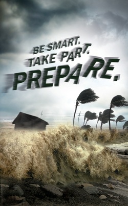 Published July 03, 2014 FoxNews.com
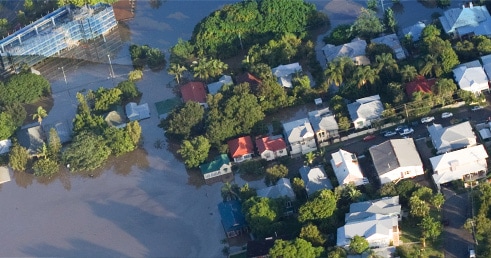
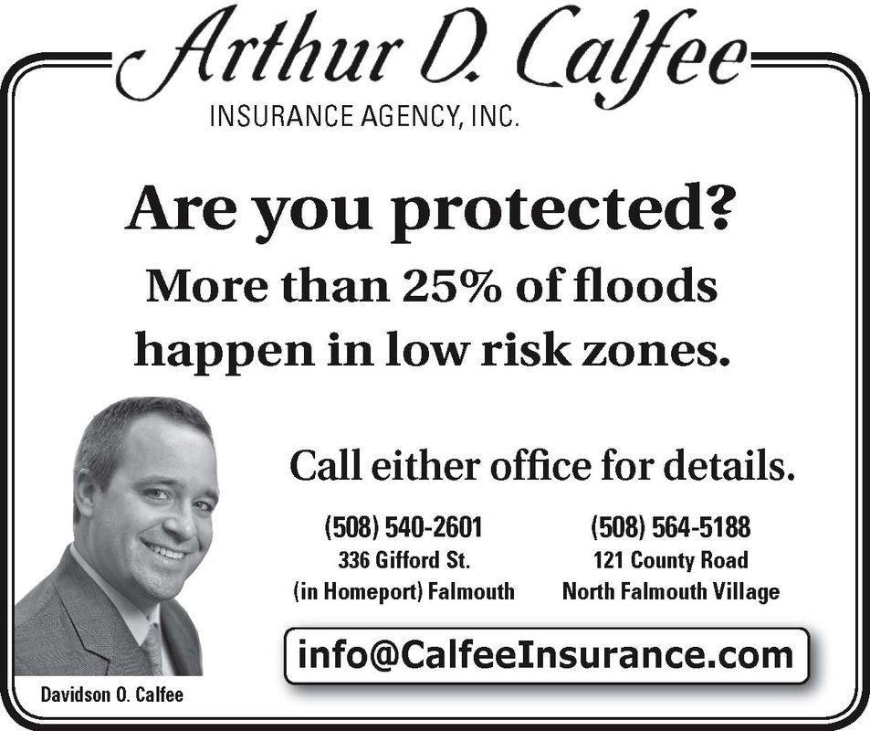
Arthur strengthened to a hurricane in the Atlantic Thursday and threatened to give North Carolina a glancing blow on Independence Day, prompting thousands of vacationers and residents to leave parts of the state's popular flood-prone Outer Banks. The hurricane's maximum sustained winds Thursday morning were 80 mph as the storm's outer bands started to reach southern parts of North Carolina. Hatteras island was under a mandatory evacuation order for visitors and residents, with officials asking an estimated 35,000 people to leave through North Carolina Route 12, the only road on and off the island. Forecasters expect Arthur to whip past the Outer Banks -- a 200-mile string of narrow barrier islands with about 57,000 permanent residents -- on Friday without making landfall but still bringing rain, heavy winds, storm surge and dangerous rip tides. Before the storm hit, tourism officials had expected 250,000 people to travel to the Outer Banks for the holiday weekend. Gov. Pat McCrory warned people not to risk their safety by trying to salvage their barbecues and pre-paid beach vacations. "Don't put your stupid hat on," McCrory said, urging swimmers and surfers to avoid the water regardless of how good the waves might look. McCrory also declared a state of emergency for 25 coastal and adjoining counties. "Our major goal is to ensure that no lives are lost during this upcoming storm," including those of emergency workers, McCrory said. The National Hurricane Center predicted Arthur would swipe the North Carolina coast early Friday with winds of up to 85 mph and then be off the coast of New England later in the day, eventually making landfall in Canada's maritime provinces as a tropical storm. Outer Banks residents and out-of-town visitors who fail to evacuate ahead of the hurricane's expected arrival should prepare for possibly getting stuck for several days without food, water or power, National Hurricane Center forecaster Stacy Steward said Thursday. "We want the public to take this system very seriously, go ahead and start their preparations because time is beginning to run out," he said. The first named storm of the Atlantic season prompted a hurricane warning for much of the North Carolina coast. Tropical storm warnings were in effect for coastal areas in South Carolina and Virginia. On the Outer Banks' Ocracoke Island, accessible only by ferry, a voluntary evacuation was under way. Arthur is centered about 300 miles southwest of Cape Hatteras, North Carolina, and is moving north near 9 mph. Officials, hotel owners and would-be vacationers as far north as New England were also carefully watching forecasts. The storm was enough of a concern that officials in Boston decided to move the annual Boston Pops July 4th concert and fireworks show up by a day because of potential heavy rain Friday night. And rip tides were a threat as far north as New Jersey. One of the Outer Banks visitors who planned to leave Thursday was Gary Reinhardt, 63, of Sarasota, Florida. "I'm worried about the road. It took way too long to get here," he said, a reference to the two-and-a-half hours it took him and his wife, Lori Reinhardt, to get onto the island last Sunday in normal summertime traffic, when no storms were in sight. Other areas of the Outer Banks were taking a cautious, but still-optimistic approach: No evacuations had been ordered for areas north of Hatteras, including the popular town of Kill Devil Hills, which was the site of the Wright brothers' first controlled, powered airplane flights in December 1903. Nancy Janitz, 60, of Jacksonville, North Carolina, said she was ready, thanks to technology. "I have my NOAA radio, and I keep tabs on Twitter and Facebook for updates," she said. "I'm as prepared as I can possibly be." Forecasters had thought Arthur would reach hurricane status later Thursday, but its increasing strength and a defined eye prompted them to revise the projection late Wednesday, the Miami Herald reported. The worst of the storm should occur at Cape Hatteras about dawn Friday, with 3 to 5 inches of rain and sustained winds up to 85 mph, said Tony Saavedra, a meteorologist at the National Weather Service. But forecasters said that by later Friday, the effects of Arthur would be past the Outer Banks, with the rest of the weekend salvaged. In the Myrtle Beach area, the heart of South Carolina's $18 billion tourism industry, Arthur was expected to move in by Thursday night, spinning wind gusts from 40 to 50 mph toward the high-rise hotels and condominiums lining the oceanfront. Farther south, in Hilton Head Island on the state's southern tip, most were confident would pass well out at sea. "It will be a sold-out weekend," said Charlie Clark, a spokeswoman for the local Chamber of Commerce. "... We're not getting calls from visitors asking what's up with this storm." The Associated Press contributed to this report.  Universal Property & Casualty Universal Property & Casualty Living on Cape Cod can be limiting in the choices regarding home insurance carriers. Most Cape Codders are familiar with the Massachusetts Property Insurance Underwriters Association or the "not so Fair Plan". A great alternative now available on Cape Cod is Universal Property & Casualty Insurance Company which can be accessed through your local agent. UPCIC is proven to have comparative deductibles and premiums. Contact a local Cape Cod agent to provide you with a free quote to see if UPCIC can save you money on premium and/or provide better coverage for your home.
UPCIC Financial Strength Has aligned itself with some of the best and most respected service providers in the industry. This functional structure affords UPCIC the opportunity to take advantage of a unique combination of financial strength, underwriting skills, analytical expertise and administrative capability. Mission The mission of Universal Property & Casualty Insurance Company and the Red Elephant is to deliver exceptional service and value to you, our customer. We offer smart solutions, financial security and peace of mind. The wisdom of the Red Elephant guarantees that we never forget our most important job,serving our customers. The Red Elephant and Universal Property & Casualty are always ready to stand by your side. Claims Underwriters are always available. Universal Property & Casualty is committed to processing all claims quickly and efficiently with every effort made to furnish the client with immediate service. Customer Service Universal Property & Casualty Insurance Company is dedicated to providing unsurpassed service to its agents and our customers. When you call Universal Property & Casualty, you will not talk to a voice mail system. A well-trained representative is ready to help. We pride ourselves on personal attention, servicing each customer's claim as if s(he) were a member of our own family. Our goal is to give our customers the quickest turnaround time possible on all claims. https://universalproperty.com/ |


Insurance InfoFor all the latest up to date insurance rates for Cape Cod, MA. CategoriesAll 5 Ways To Prevent Your Basement From Flooding Arbella Insurance Auto Insurance Bad Weather Driving Best Boat Insurance Best Car Insurance Best Insurance Best Policy Bourne Flood Insurance Bourne Home Insurance Buildings Buildings And Content Insurance Cape Cod Boat Cape Cod Flood Insurance Cape Cod Home Cape Cod Home Insurance Cape Cod Home Insurance Best Cape Cod Home Insurance Marthas Vineyard Insurance Falmouth Home Insurance Mashpee Home Insurance Cape Cod Home Insurance Falmouth Home Insurance Cape Cod Real Estate Cape Cod Home Insurance Falmouth Home Insurance Cape Cod Real Estate Universal Home Cape Cod Home Insurance Falmouth Home Insurance Cape Cod Real Estate Universal Home Universal Property Cape Cod Insurance Agency Home And Auto Insurance Car Insurance Car Owner Guides Centerville Home Insurance Home Insurance Agent Cape Cod Insurance Agent Cape Cod Insurance Agency Home And Auto Insurance Coastal Agents Alliance Community Outreach Contents Contents Insurance Dennis Home Insurance Yarmouth Home Insurance Vineyard Haven Home Insurance Nantucket Home Insurance Disability Safety Disaster Safety For People With Disabilities: What To Do When Emergency Weather Strikes Do I Need Flood Insurance Driver Safety Driving To Safety: The Car Owner's Guide To Emergency Evacuation Emergency Evacuation Emergency Evacuation Preparedness Falmouth Flood Insurance Falmouth Home Insurance FEMA Flood Program Flash Flood Safety: 5 Must Ask Questions Flash Flood Safety: 5 Must-Ask Questions Flood Flood Damage Flooding Flood Insurance Flood Insurance Costs Flood Insurance Rates FLOODS AND YOUR LIVESTOCK Guide Guide To Safe Driving Home Home And Car Insurance Home Insurance Home Insurance Agent Cape Cod Insurance Agent Cape Cod Insurance Agency Home And Auto Insurance Home Insurance Cape Cod Home Insurance Best Cape Cod Home Insurance Marthas Vineyard Insurance Falmouth Home Insurance Home Insurance Cape Cod Home Insurance Best Cape Cod Home Insurance Marthas Vineyard Insurance Falmouth Home Insurance Mashpee Home Insurance Sandwich Home Insurance Bourne Home Insurance North Falmouth Home Insurance Marion Home Insurance Household Insurance Information & Resources Insurance Insurance Emergency Strikes' Insurance Flood Insurance Policy Maps: Which Parts Of The U.S. See Flash Floods Most Often? Marion Home Insurance Plymouth Home Insurance Dennis Home Insurance Yarmouth Home Insurance Mashpee Flood Insurance Mashpee Home Insurance Mashpee Home Insurance Sandwich Home Insurance Bourne Home Insurance North Falmouth Home Insurance Narragansett Insurance National Flood Insurance Program Plymouth Home Insurance Dennis Home Insurance Yarmouth Home Insurance Vineyard Haven Home Insurance Nantucket Home Insurance Yarmouth Home Insurance Possessions Preparing For Vehicle Emergencies Prevent Flooding Replace Right Insurance Safe Driving Guides Safety Guide Safety Guides Tags: Safety Safety Insurance Sandwich Home Insurance Sandwich Home Insurance Bourne Home Insurance North Falmouth Home Insurance Marion Home Insurance Plymouth Home Insurance The Ultimate Guide To Hurricane Facts Universal Home Universal Property UPC Insurance MPIUA Mass Property Fair Plan Fair Plan Alternative Universal Insurance Universal Property UPC Insurance MPIUA Mass Property Fair Plan Fair Plan Alternative UPCIC Insurance UPC Insurance UPC Insurance MPIUA Mass Property Fair Plan Fair Plan Alternative Vehicle Emergency Kit Vehicle Safety Vineyard Haven Home Insurance Nantucket Home Insurance Yarmouth Home Insurance Centerville Home Insurance Water Damage Wind Vs. Hurricane Deductibles Wright Flood Yacht Insurance Yarmouth Home Insurance Centerville Home Insurance Home Insurance Agent Cape Cod Insurance Agent Archives
June 2021
|
-
HOME
- Cape Cod, MA - Send me a Home Quote
- Cape Cod, MA Home Insurance Protection
- Arbella Insurance Discounts
- Lloyds of London History
- Safety Insurance Discounts
- Cape Cod Massachusetts - Alternative to MPIUA - MA Property Insurance Underwriting Association "Fair Plan"
- Cape Cod Real Estate
- Hurricane Preparedness
- Hurricane Survival
- Hurricane Aftermath
- FLOOD
- Cape Cod Home Insurance
- AUTO
- BOAT
- BUSINESS
- LIFE
- OFFICES
- ABOUT US
- eServices
- Agent Login
- Contact Us
- Privacy Policy
Search by typing & pressing enter
 RSS Feed
